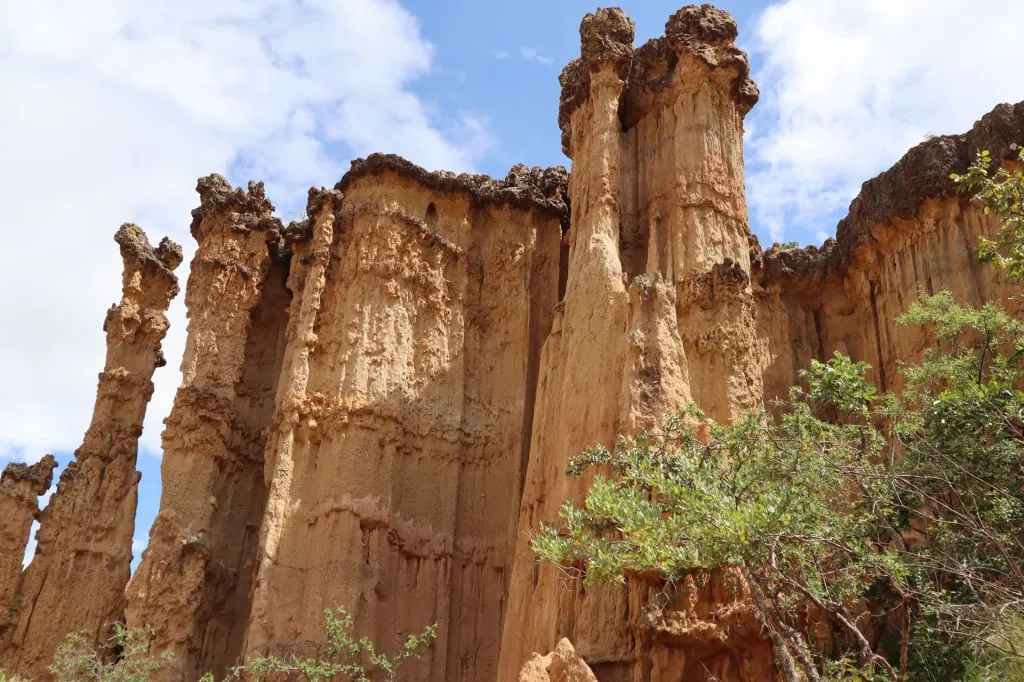
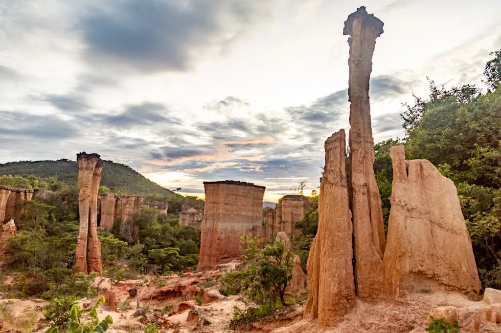
One of the most unusual phenomena on the planet is the many-meter-high natural pillars of the Isimila valley korongo located in southern Tanzania, East Africa. Walking under them, you can’t help wondering how nature was able to create such incredible things. Apart from its outstanding beauty, this site is famous for the valuable archeological findings that were made here. It's time to embark on a new journey with Altezza Travel!
The mysterious stone pillars of Isimila
When you find yourself in the canyon with yellow-brown sandstone pillars towering above you, it makes you marvel at the beauty and ingenuity of the forces of nature that created these intricate works of art. But then you wonder and ask yourself if you’re really in Africa. What always comes to mind when we think of Africa is its endless savannas studded with acacias, tropical river basins, and stone mounds from which lions survey their domains. Vast deserts and, of course, the iconic Mount Kilimanjaro with its white glaciers are also on the list of associations. But a canyon on the site of a dried-up lake? You probably don’t expect to see that here.
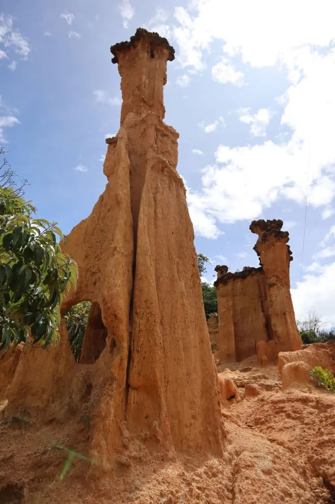
Perhaps canyon is too loud a word. One immediately thinks of the Grand Canyon in Arizona, USA, carved by the Colorado River. Or of the deepest canyon in the world, Cotahuasi, in Peru, which is more than 3,300 meters deep. The depth of the Isimila site is more modest - the pillars reach up to thirty meters in height. By analogy, one might rather think of Phae Mueang Phi in Thailand or the Serbian "Devil’s Town". Perhaps, it would be more correct to name it a ravine. However, this geological formation still remains most unusual. The most accurate word to describe it would be korongo, which just means a ravine that has undergone erosion.
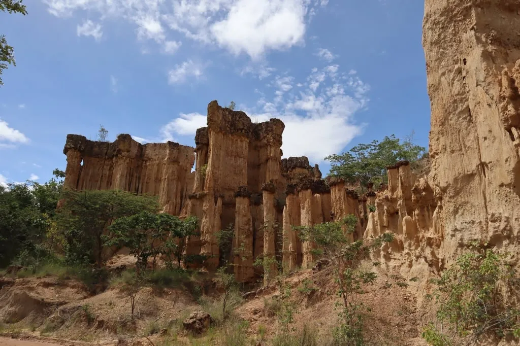
What is Isimila and where is it located? It is a valley spread out in the southern part of Tanzania, between two national parks: Udzungwa Mountains and Ruaha, in the region with the beautiful name of Iringa. It is located 20 kilometers from the homonymous town of Iringa, near the village of Ugwachanya. The most remarkable part of the valley is the deep ravines in the sandstone. You can walk through these formations admiring the bizarrely shaped natural pillars above. They are the result of a very long process of erosion. Once there was a lake in this place, but later it dried up and the winds continued the work of eroding the rock.
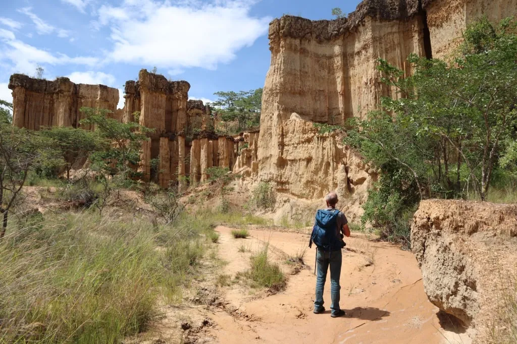
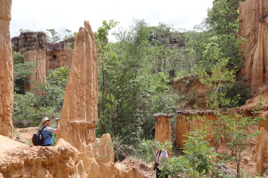
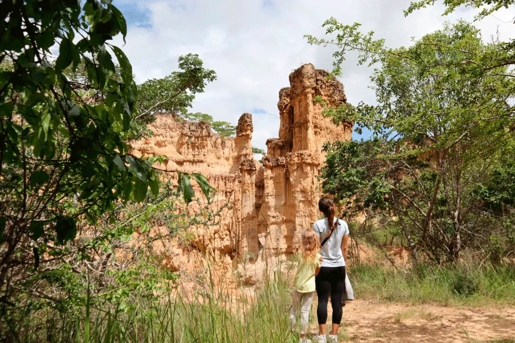
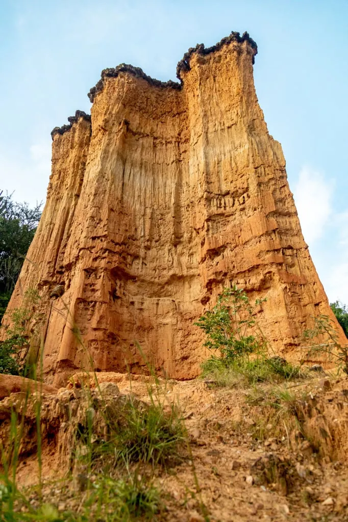
Today one can stand at the bottom of the canyon and gaze at the magnificent sandstone columns two or three dozen meters high. It feels as if you are in a museum, where the works of skilled artisans-giants who lived in ancient times are on display. A long corridor channel invites you for a walk, and along the way, you will notice the sheer walls of sandstone, some of which have inaccessible small caves high up. Sometimes it seems that you came to a dead end and there is no further way, but around the concealed turn, the path to the next gallery will open.
Interestingly, the pillars at the bottom of the ancient river bed are not the only attractions of Isimila. Nearby, a site of ancient Hominidae (hominids) is a family of the order of primates that unites the genus humans and their extinct ancestors, as well as three genera of modern great apes (orangutans, gorillas, chimpanzees). was discovered. They were either direct ancestors of modern humans or their closest relatives. Isimila is recognized by archaeologists as a site of international importance, with the major discoveries apparently yet to come. So far, the place is marked by fascinating findings of fossilized extinct animals and of some of the earliest hand tools of prehumans - faceted stone axes of granite and quartzite.
Today, little is known about the first hominids that lived outside the The Great Rift Valley, or the East African Rift, is a major geological formation recognizable to us through the mountains of East Africa, such as the volcanoes of Ol Doinyo Lengai, Kilimanjaro, and the Ngorongoro Plateau. The tectonic plates continue to slowly move, and the voids between them are filling up with water today (The Red Sea; lakes Victoria, Tanganyika and others). This process will eventually turn East Africa into an island in the Indian Ocean.
The Olduvai Gorge in northern Tanzania became widely known for the important archeological findings made in the 1960s, most notably the skulls of the first hominids in the lineage of modern humans. In Isimila, however, the scientists are only just getting close to significant future discoveries. Excavations and studies are taking place today, but not yet at the scale that can yield significant breakthroughs in understanding how our ancestors from the East African Rift Valley were settling across the continent.
Perhaps the absence of mass-scale excavations at the present is even to the advantage of tourists, who so far have free access to the canyon system in Isimila, where they can see the majestic natural pillars up close and take impressive photos.
Who were the early explorers of Isimila?
In 1951 two travelers, Mr. Maclennan, a teacher from Johannesburg, and his buddy Mr. Lilly were traveling south on the
The Great Northern Road was the name given to The Cape to Cairo Road, which the British authorities intended to build through their African colonial territories. A paved highway and a telegraph line were thus to cross all of Africa from north to south.
The road was first proposed in 1874. The first attempt to travel this route ended in failure in 1914 as Captain Kelsey was killed by a leopard on the way. In 1924 the first successful expedition was completed - two light trucks were driven on dirt roads for 1 year, 4 months and 1 day. After that, the construction of asphalt roads through present-day Egypt, Sudan, Ethiopia, Kenya, Tanzania, Zambia, Zimbabwe, Botswana and South Africa began. The middle of the route was in the city of Arusha in Tanzania. By the mid-1950s, construction was interrupted due to the fall of the colonial regime.
Today, the old idea is gradually being implemented, but now by the UN, the African Union and the African Development Bank. In the Trans-African Highway network under construction, this route, with minor modifications, is included as the Trans-African Highway 4 (Cairo-Cape Town Highway), and is 10,228 kilometers long! South of Iringa, near a small
Tanganyika was the name of the East African territory under British rule from 1919 to 1961. It later became the mainland part of Tanzania. town founded by the Germans, they noticed an unusually shaped ravine. They were amazed by it and the discovery quickly caught the attention of the scientists. This is how one of the most interesting archaeological sites on the planet became known to the modern world.
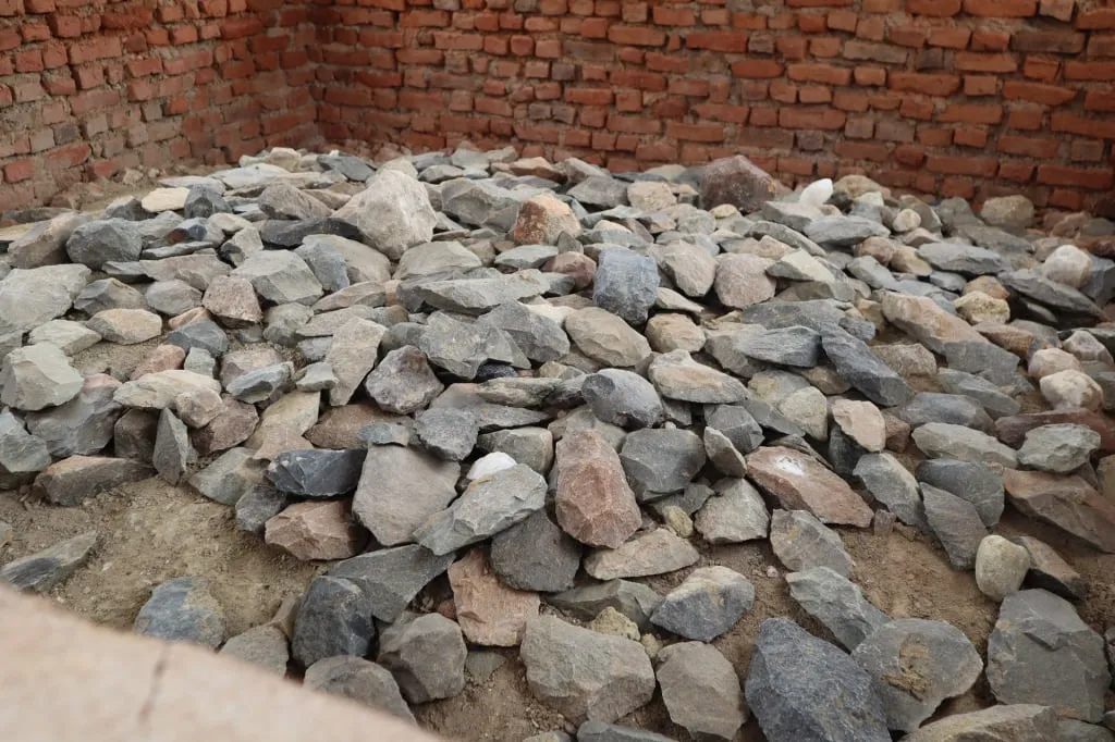
In the second half of the 1950s, scientists were working here to study the geology and geomorphology of the region. Back then hundreds of stone implements of the so-called Ashelian culture were found: hand axes, scrapers, knives, disks, choppers, and other tools for cutting carcasses, as well as tools used in daily tasks during the ages when the ancestors of humankind were discovering labor. It was immediately assumed that the finds are about 260,000 years old. Now scholars estimate that those objects could be 75,000 to 300,000 years old, judging by the appearance of artifacts. But even these dates are very vague.
These days, new research is being conducted to clarify the dating of the ancient tools unearthed at this site. Scientists are taking samples of various sediments in the area and using modern analysis techniques to understand where the early humans were extracting the material for their axes and knives. After that, it will be possible to tell the age of the tools more precisely.
In addition to the artifacts of the Acheulian culture, scientists have found fossils of ancient animals in Isimila, for example of the now extinct species of hippopotamus gorgops. Other findings include fossils of now-extinct species of pig and giraffe which had shorter necks relative to the modern animals.
The main researchers at this site were the geologist Francis Clark Howell, who wrote a detailed report in 1962, and the famous archaeologist Louis Leakey, who studied the fossils of ancient animals. But no in-depth studies, much less real large-scale excavations, have ever been conducted on the site of this ancient settlement. That is why the Isimila Stone Age Site remains of great interest to archaeologists, and scientists have more questions than answers about the life of the ancient people who lived at Isimila.
How were the Isimila columns formed?
The formation of the pillars is well studied and understood by specialists. 300,000-400,000 years ago, there was a lake on the territory of the present-day canyon with the streams that fed it. But the climate in this part of Africa was changing, becoming drier. The lake was gradually drying up, and the waters were slowly eroding the rock. The softer rock crumbled, leaving pillars of harder geological material. There were two processes going on in parallel: erosion, and the transport of the material with its subsequent deposition elsewhere. This is how scouring, ravines, and valleys were formed.
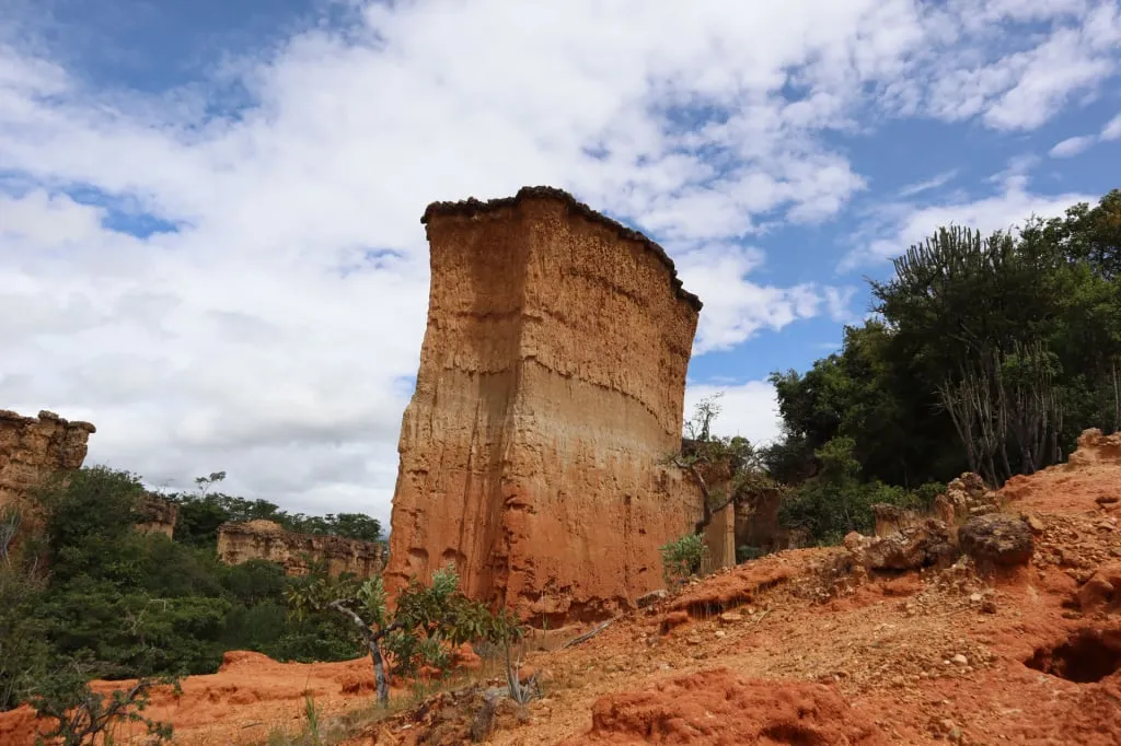
When the lake dried up completely, the korongo began to be weathered by the wind which was grinding the sandstone ridges and arches formed earlier. Many of their parts have gradually collapsed. This is how the freestanding pillars were formed, with rock on all sides washed away, crumbled, and weathered. The process, of course, is still ongoing but because it is fairly slow we will still be able to observe these unusual natural sculptures for generations to come.
Today the territory of the korongo at Isimila is managed by the Tanzanian National Parks Administration and is visited by tourists who want to see this natural wonder with their own eyes - magnificent sandstone columns standing at the bottom of an ancient lake that dried up millennia ago.
Isimila Stoneage Walk: How does the tour go?
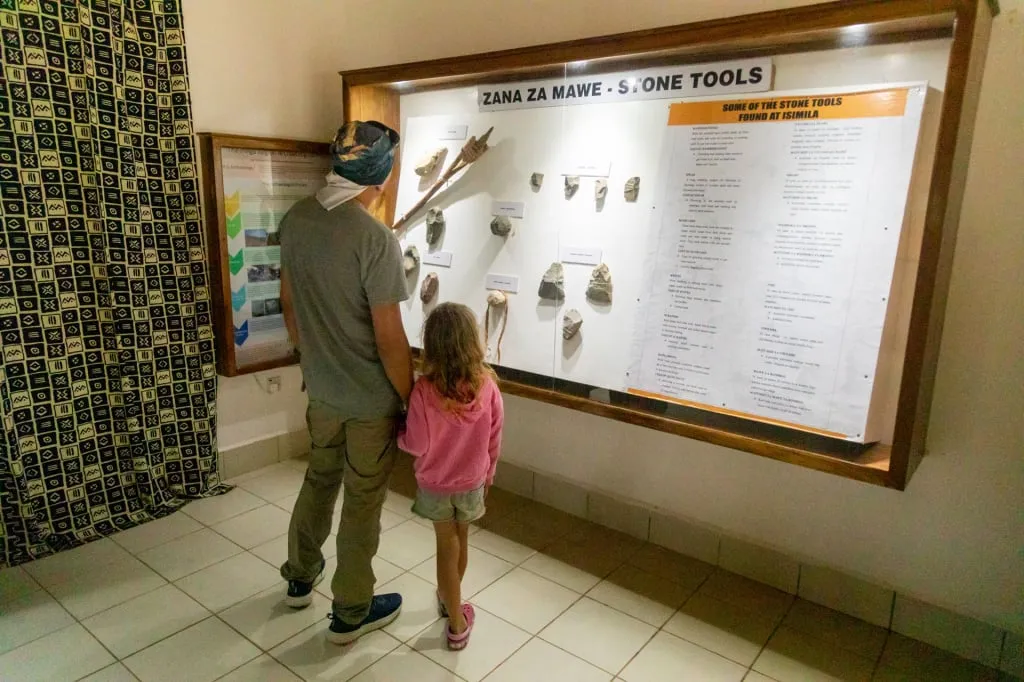
After a fifteen-minute drive south from Iringa, tourists turn off at a sign to the Isimila Stone Age Site and Natural Pillars. The straight road along the fields leads directly to the museum of the same name. There are several examples of ancient stone and iron tools on display, as well as modern items of the local art of basket weaving, which is considered one of the famous cultural features of the Hehe people living in this region.
There are photographs in the museum showing the life and crafts of the Hehe. Part of the exposition is dedicated to the guerrilla war of the Hehe against the German colonists in the 1890s. The Germans were brutally suppressing rebellions of the unruly southern peoples of what was then German East Africa was the name of the German colony in Africa, which included the territories of present-day Tanzania, Mozambique, Burundi, and Rwanda. It existed from 1885 to 1918, after which Germany, defeated in World War I, withdrew from the region, placing the colonial territories under the protectorate of Britain, which was more flexible in its interaction with the local population. In response, the Hehe people arranged successful attacks and once even seized a fortress with weapons, slaughtering a couple of hundred Germans. The guerrilla war was led by Chief Mkwawa, who is considered a national hero in Tanzania. Interestingly, the town of Iringa itself near Isimila was founded by the German army with the purpose of suppressing the Hehe.
At the Isimila Stone Age Site Museum, there are also several stands that tell us about the history behind the geological studies at Isimila in the 2000s, as well as some information about human evolution during the Stone Age. Homo sapiens, the modern species of human, was formed during that period of time, which is why scientists are so interested in understanding the evolutionary processes that took place here.
At the museum, visitors take a guide to travel in his company to the stone towers in the basin of the parched lake - it's difficult to find the way on your own without getting lost.
The guide will take you from the museum to the canyon, showing a large collection of stone tools found in the ancient settlement, which are on display under a separate small structure. Then the tour will continue to the beginning of the trail that will take you along the bottom of the korongo. The road from the museum to the starting point of the trail takes 15-20 minutes.
The trail begins by descending into the canyon below the power lines. Even here the sandstone pillars are impressive. Their shapes are bizarre, and you can notice individual layers of rock by which geologists trace the history of their formation. Some pillars are shaped like freestanding walls, while others have through holes that give us an idea about how the erosion forces work.
The trail along the bottom of the korongo is loop-shaped, so after making a circle visitors will emerge at about the same place where they started the route. Even today, water runs along the bottom of the canyon. The width and depth of the stream vary depending on the time of year - in the rainy months there is more water, and in some places, the streams have to be traversed on rocks.
Along the way, the guide talks about the history of the formation of this place, as well as about the findings made here. The high-walled ravines were a convenient natural enclosure where game could be chased and surrounded. This could be one of the reasons why ancient people chose to settle here. In all likelihood, many more interesting things will be discovered on this site during future excavations.
The entire walk takes one to three hours, depending on how fast or slow you choose to walk. The best time to visit the korongo at Isimila is in the morning hours when the sun is not yet so high and the weather isn’t too hot. Although there are shrubs and even small trees in the canyon, they don’t provide much shade.
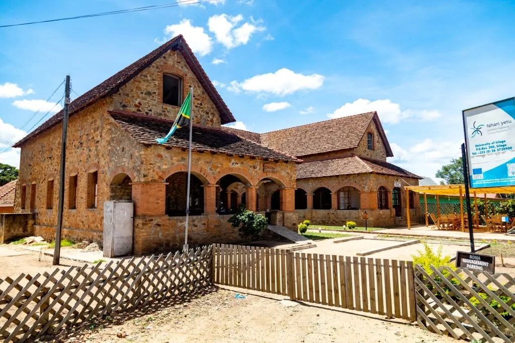
By the way, at the center of Iringa, there is an interesting museum - Iringa Boma. It is a beautiful structure of stone and brick with a tiled roof built in 1914. You can spend some time there studying the samples and exhibits that demonstrate the history of the city and the region. History enthusiasts will be delighted by the numerous stands that contain interesting materials with photos and maps showing the life of the Hehe people. The museum itself occupies three small rooms, but by the standards of provincial Tanzania, it is very informative and interesting.
In Iringa Boma, you will find old German weapons, including a cannon that stands at the entrance to the museum, as well as everyday objects such as traditional towels, wooden mortars with pestles for manually grinding flour, kitchen utensils, and of course the kalabash, a traditional vessel made from dried gourd. There are also stone tools from the nearby ancient settlement and even the pillars of Isimila in miniature. The museum also tells us about Ruaha National Park and the neighborhood of Iringa.
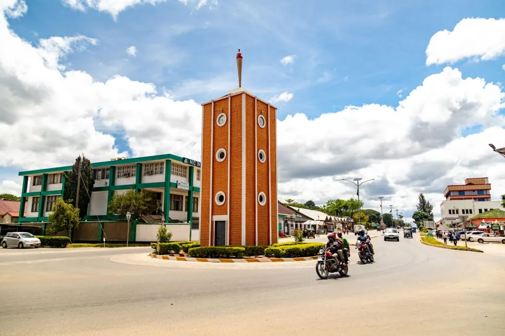
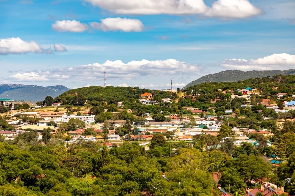
The town itself is very beautiful, and it will be worth your time to dedicate at least one day to it. The historic center preserves the memory of its German heritage, and you can visit the old German market, the military station, and the neat military cemetery. There are also authentic Tanzanian objects of architecture and culture: the main street with a clocktower (which is traditional for Tanzanian cities), monuments dedicated to the Second World War and to the The Maji-Maji Rebellion was a 1905-1907 uprising of native tribes against the German colonialists who pursued a policy of brutal exploitation and oppression of the indigenous population in East Africa. The word "maji" means "water" in Swahili, which is what the magic of maji-maji (water with castor oil and millet seeds) would turn German bullets into, as the popular local medium assured everyone else. The magic did not work, the uprising was brutally suppressed by the German army, and the local population was later crushed by a famine that, according to some estimates, killed up to 300,000 people. as well as a very important local monument called Kitanzini - a place with a tree where the Germans used to hang the most unruly Hehe warriors to terrify the other locals. But even apart from the military objects, Iringa is full of interesting places and beautiful views - the city is located on the hills and it is a real pleasure to look at the roofs of the houses and streets running in different directions.
There are many more natural and cultural attractions scattered around the city, which the map at the Iringa Boma Museum will point you to. A visit to the Isimila canyon can be combined with a stop in Iringa. Then your experience will be greatly enriched, and the stone pillars at the bottom of a long-dried reservoir will be a memorable addition to a trip to the south of Tanzania, in the heart of East Africa, where the human race once began its history.
All content on Altezza Travel is created with expert insights and thorough research, in line with our Editorial Policy.
Want to know more about Tanzania adventures?
Get in touch with our team! We've explored all the top destinations across Tanzania. Our Kilimanjaro-based adventure consultants are ready to share tips and help you plan your unforgettable journey.



Seems very captivating, the stones, the city and culture around it...