It seems you are one of those who loves looking at maps. Let's find the highest African mountain on the continent's map and take a closer look at the map of Kilimanjaro itself. This will be useful for everyone planning to climb Kilimanjaro—the highest peak on the African continent.
Finding Mount Kilimanjaro on the world map
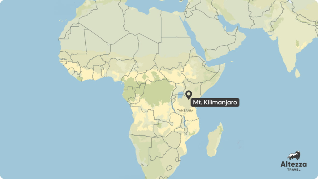
Finding Kilimanjaro on the world map is easy: start by locating Africa, almost divided in half by the equator. You will find a solitary mountain just south of the equator in the eastern part of the continent. Good landmarks include the largest African lake—Lake Victoria, and the border between Kenya and Tanzania. Kilimanjaro is right at the border, to the right of the lake.
More about where Kilimanjaro is located and why some people look for the mountain in Kenya instead of Tanzania can be found in the article where we share the coordinates of Africa's main attraction, among other interesting facts.
For those who love details, we suggest looking at the interactive Mt Kilimanjaro Map. Here it is, surrounded by roads in northern Tanzania.
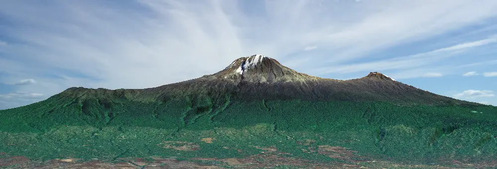
The extensive green area around the brown spot represents the mountain's slopes covered with rainforests. The light brown zone is the rocky summit, with no plants and thus no animals. It is located at over 5,000 meters (16,400 feet) above sea level.
The map shows that the mountain is located in Mount Kilimanjaro National Park. This means that starting from about 1,800 meters (5,905 feet) above sea level, no people are living on the mountain, and its slopes are protected as a national treasure of Tanzania. If you zoom in on the map, you can see many interesting features on Kilimanjaro: tourist camps, lodges for overnight stays, individual glaciers, and of course, it's highest point—Uhuru Peak.
Facts about Kilimanjaro
Here are some interesting facts about Mount Kilimanjaro to help you understand why there are so many features on its map.
Kilimanjaro is a Volcano
To be more precise, Kilimanjaro consists of three volcanoes. The highest, whose summit everyone aims to reach, is the youngest and tallest. It is called Kibo. To the east of it is the Mawenzi volcano, which only professional climbers with technical equipment can ascend. The third volcano has almost completely eroded during an eruption by the newest volcano. But it once stood to the west of Kibo. Now there is a beautiful plateau called Shira. Each of the three volcanoes has its highest peak. Those are: Johnsell Point (3,962 meters or 12,999 feet) on Shira, Hans Meyer Peak (5,149 meters or 16,893 feet) on Mawenzi, and Uhuru Peak (5,895 meters or 19,341 feet) on Kibo.
Kilimanjaro is the Highest Mountain in Africa
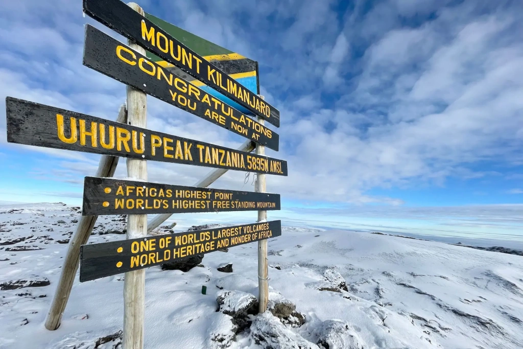
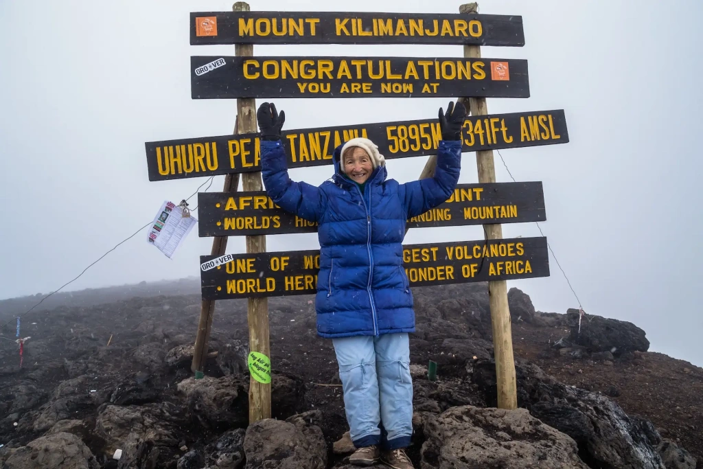
The height of Kilimanjaro is 5,895 meters (19,341 feet) above sea level. This is indicated in many sources. You can see this number on the stand at the summit and on the medals awarded to those who reach the main peak. However, accurate measurements in 2008 provided a figure of 5,891.8 meters (19,330 feet). This still makes Kilimanjaro the highest mountain on the continent. In Tanzania, it is called the "roof of Africa."
Kilimanjaro is a part of the Seven Summits
Kilimanjaro, being the highest mountain in Africa, is a part of the Seven Summits—a group of mountains, each considered the highest for its continent or part of the world. The other mountains are:
- Aconcagua in South America
- Denali in North America
- Vinson Massif in Antarctica
- in Europe
- Everest in Asia
Learn more about the Seven Summits and the people who "collect" them in our article about climbing those peaks.
Mount Kilimanjaro is a popular peak for trekking expeditions
Each year, more than 50,000 people aim for the summit of Africa's highest mountain. Among them are both professional climbers and beginner hikers, who often combine the Kilimanjaro expedition with a safari in Tanzania's national parks. Arusha National Park is the closest safari destination, but many other iconic Tanzanian national parks are also not far away. For example, the Ngorongoro Crater or the Serengeti National Park that borders Kenya's Maasai Mara National Reserve.
You can head to the "roof of Africa" at any time. Read our articles about Kilimanjaro and plan your expedition. Altezza Travel will be happy to organize your trip. Join us!
The slopes of Kilimanjaro are divided into Five Climatic Zones
It is often said that climbing from the base of Kilimanjaro to the summit is like traveling from the tropics to the North Pole. This is because the climber crosses five different climatic zones. These zones on Kilimanjaro are:
- The cultivation zone, where locals grow crops, ends at an altitude of 1,800 meters (5,900 feet) above sea level
- Rainforest zone—tropical forests with high rainfall extend up to 2,800 meters (9,200 feet)
- Heath and moorland zone with unusual plants, such as Giant Lobelia and Kilimanjaro Groundsel, continue up to 4,000 meters (13,100 feet)
- Alpine desert with rocks, mosses, and lichens occupies heights up to 5,000 meters (16,400 feet)
- The Arctic zone extends above 5,000 meters (16,400 feet) above sea level and is a stony desert with glaciers and snow periodically covering the areas at this altitude
There are glaciers on Mount Kilimanjaro
At the summit of Kilimanjaro, just 340 kilometers (211 miles) from the equator, there are glaciers. They are almost 12,000 years old. Nowadays, those ice structuress are rapidly disappearing due to sublimation, melting, and evaporation. Over a hundred years, from 1912 to 2011, the glacier area decreased by 85%. Some of them have disappeared forever, while others are rapidly shrinking. Currently, Kilimanjaro has three ice fields and 16 separate glaciers. The most famous glaciers on Kilimanjaro are:
- Furtwängler Glacier
- Decken Glacier
- Kersten Glacier
- Rebmann Glacier
- Drygalski Glacier
It is expected that the last remnants of ice on Kilimanjaro will disappear by 2050.
Uhuru Peak—the highest point of Kilimanjaro
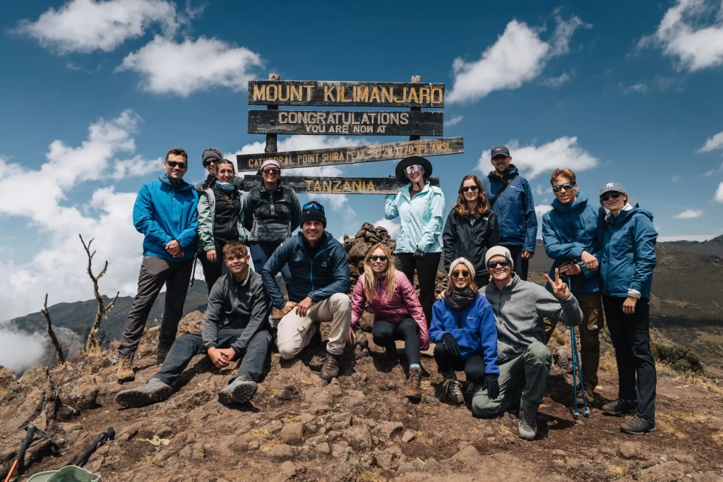
The highest point of Mount Kilimanjaro is Uhuru Peak. It is a small elevation on the edge of the outer rim of the Kibo volcano. The official height of the peak is 5,895 meters (19,341 feet) above sea level. It is the ultimate goal for all participants in Kilimanjaro expeditions. The word "uhuru" translates from the local Swahili language as "freedom," referring to Tanzania's independence gained in the 1960s.
Mount Kilimanjaro has several craters
Kilimanjaro's central volcano, Kibo, is located between the Shira plateau and Mawenzi volcano. It features a cone that is 24 kilometers (15 miles) wide at the base. At the top of Kibo is a large crater 2.5 kilometers (1.55 miles) across, formed from a summit collapse 150,000–200,000 years ago. The volcano became active again after this collapse, creating a new cone inside this crater, known as the Inner Cone, which measures 1.3 kilometers (0.8 miles) across. Within the Inner Cone is the Reusch Crater, 820 meters (2,690 feet) in diameter, named after Gustav Otto Richard Reusch who attempted to climb Kilimanjaro 65 times in the early 20th century. Inside the Reusch Crater lies the , a 340-meter (1,115-foot) wide and 200-meter (656-foot) deep pit, serving as the main vent of the volcano. Read more about the Reusch Crater and its namesake in our blog post.
Several routes lead to Uhuru Peak
To reach the summit of Kilimanjaro, you can take several official routes. Here they are:
- Lemosho route
- Machame route
- Marangu route
- Rongai route
- Northern Circuit route
- Umbwe route
- Kilima route
- Western Breach route
There are several variations of the main routes up the mountain, along with some less popular ones like the Shira route and Loitokitok. Some begin on their own but eventually join the main Kilimanjaro routes, while others start merged with the main paths but later split off, giving travelers the opportunity to avoid the most crowded camps and trails. A good example of such route is the Northern Circuit. By the way, there is also a Southern Circuit, connecting Marangu with Umbwe.
All these paths to Uhuru Peak can be used during the ascent. However, the Mweka route is only used for descent. The backup descent Kilimanjaro route is Marangu. Incidentally, Marangu is the only route with huts for overnight stays and permanent toilets. On all other Kilimanjaro routes, tented structures are used for camps.
Explore more interesting facts about Kilimanjaro in our blog post. Another blog post contains a detailed description of Kilimanjaro routes and our expert opinion on each of them is provided in a Q&A format to help you choose the perfect route for your Kilimanjaro expedition.
Let's look at the Kilimanjaro map to get an overview of the routes and main points on the mountain.
Mount Kilimanjaro Map
Questions about Climbing Kilimanjaro
In what country is Mount Kilimanjaro?
Mount Kilimanjaro is located in East Africa, in Tanzania, near the border with Kenya. If you plan to climb the highest mountain in Africa, look for flights to Kilimanjaro International Airport (JRO).
What is the nearest city to Mount Kilimanjaro?
The nearest city to Kilimanjaro is Moshi. It is the capital of the Kilimanjaro region, where the mountain is located. It is the second most popular tourist center in Tanzania after Arusha, attracting climbers and visitors to national parks. Moshi has a small airport designed for domestic flights. For international flights, it is most convenient to fly into JRO (KIA)—Kilimanjaro International Airport.
How long does it take to climb the mountain?
An expedition to Kilimanjaro typically takes seven days. There are shorter expeditions for those well-prepared for high-altitude acclimatization, such as 5-day trips. For regular climbers, expeditions lasting 6–8 days are recommended. If you wish to spend the night in the Kilimanjaro crater, the expedition extends to 9–10 days. Our detailed analysis can help you understand how long it takes to climb Kilimanjaro via different routes.
Is it difficult to climb Kilimanjaro?
Kilimanjaro is not considered a difficult mountain compared to others on the Seven Summits list. However, those without mountain expedition experience might find it challenging. Beginners often struggle during the last two days of the expedition due to the tiring summit push and long descent. Nonetheless, almost any healthy person can reach Uhuru Peak. There is no official success rate for Kilimanjaro climbs, but based on our 10 years of experience, the success rate for the recommended Lemosho route is 95%. For more details on the difficulty of climbing Kilimanjaro, see our in-depth article.
Can a beginner climb it?
Yes, a healthy and physically active person without high-altitude climbing experience can complete the journey from the national park gates to Uhuru Peak. Our 10-year experience confirms this: teenagers, elderly people, women, men, and even individuals with certain health conditions have successfully climbed Kilimanjaro with Altezza Travel. If you have health concerns, consult your doctor to understand how easy the climb will be for you. If you have decided to climb the "roof of Africa," read our comprehensive guide on how to prepare for the Kilimanjaro climb.
Is Kilimanjaro in the death zone?
No, Kilimanjaro is not in the death zone. This death zone starts at 8,000 meters (26,247 feet) above sea level. It is called the death zone because the air at that altitude contains insufficient oxygen for prolonged human survival. The maximum height of Kilimanjaro is 5,895 meters (19,341 feet).
How many climbers died in Kilimanjaro?
Reliable statistics are hard to come by. Estimates suggest 3–5 climbers die on Kilimanjaro each year. Approximately 50,000 people attempt to climb the mountain annually, and this number is rapidly increasing. Most climber deaths are due to pulmonary or cerebral edema from inadequate acclimatization, or heart attacks. Among mountain crew members—porters and guides—the mortality rate is higher due to poor working conditions provided by some “budget” tour operators. Notably, over 10 years of guiding, Altezza Travel has not lost a single client.
All content on Altezza Travel is created with expert insights and thorough research, in line with our Editorial Policy.
Want to know more about Tanzania adventures?
Get in touch with our team! We've explored all the top destinations across Tanzania. Our Kilimanjaro-based adventure consultants are ready to share tips and help you plan your unforgettable journey.


