On the map of Mount Kilimanjaro, you can find a waypoint named Gilman's Point. What is this place, why is it noteworthy, and how do you get there? This article provides a comprehensive guide to Gilman's Point on the crater rim of Mount Kilimanjaro, detailing its history and its importance today.
What is Gilman's Point, Kilimanjaro?
When climbing Kilimanjaro, travelers aim for the mountain’s actual summit — Uhuru Peak. But there are other noteworthy summit points that you will reach ascending the "roof of Africa".
Gilman's Point is one of the three official summit points on Mount Kilimanjaro, where you can take a break, enjoy the surroundings, and have a small photo session. From here, it's about a two-hour hike to Uhuru Peak.
Gilman's Point is located where the Marangu route meets the crater rim of . Marangu is one of the most popular routes to climb Kilimanjaro because it has huts for overnight stays. All other routes require camping in tents. But other trails cross Gilman's Point as well, such as Rongai and Northern Circuit routes. The Northern Circuit is famous as the newest and longest Kilimanjaro route.
How high is Gilman's Point?
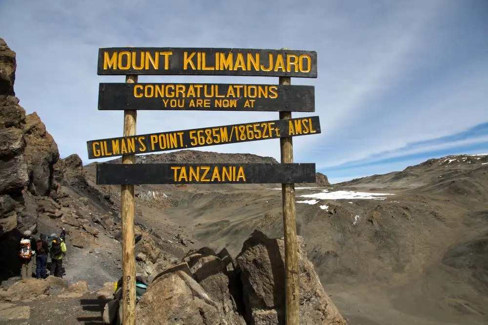
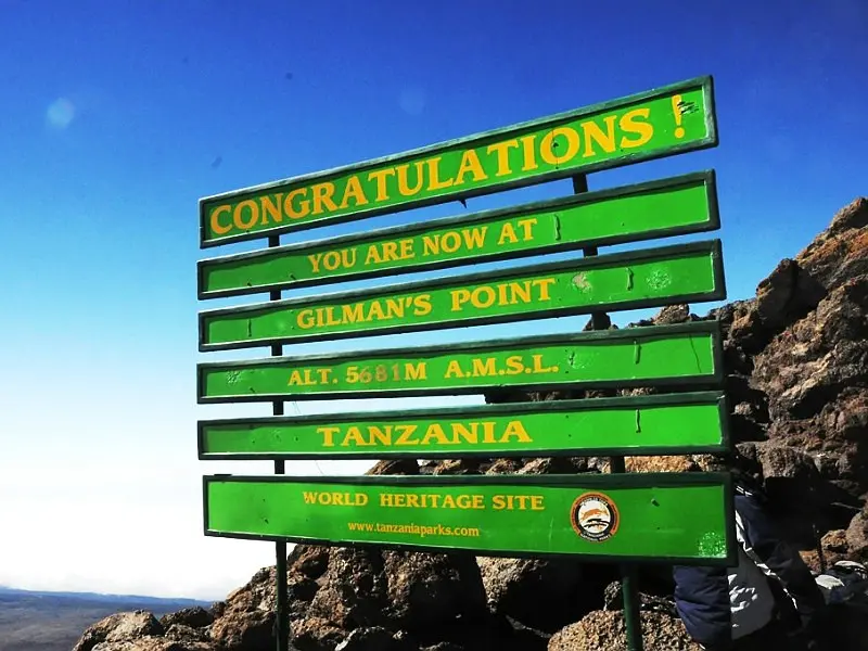
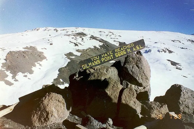
Upon reaching Gilman's Point, one can see a sign installed by the administration of Kilimanjaro National Park. It indicates an altitude of 5,685 meters (18,652 feet) above sea level.
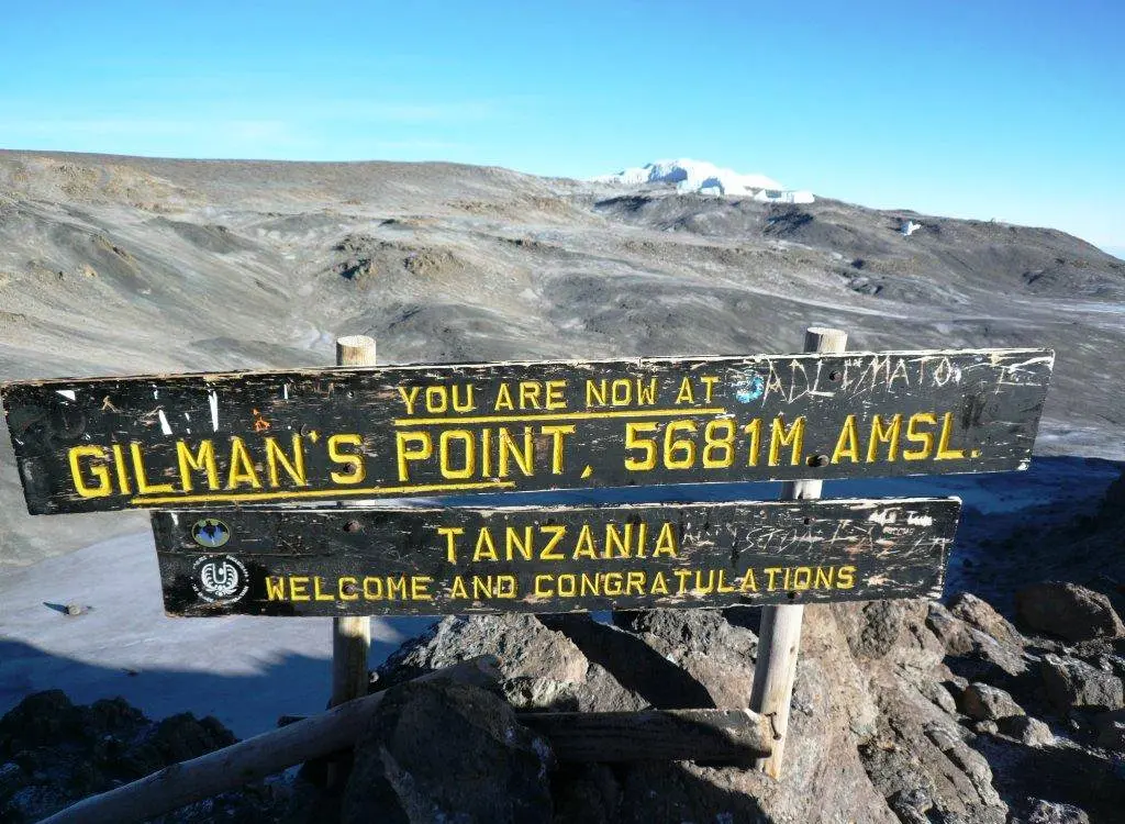
But it wasn't always like this. Previous signs indicated a different number, four meters lower — 5,681 meters (18,638 ft). That height is considered historically accurate for Gilman's Point.
Where is Gilman's Point located?
On the map, one can see that Gilman's Point is located close to Stella Point. This is another one of the three summit points with a sign, located at the exit of other routes to the edge of the crater.
Gilman's Point, Stella Point, Uhuru — three summits on the crater rim
On Kilimanjaro, there are three points, reaching which you can receive a certificate for climbing Kilimanjaro, Africa's highest mountain. All of them are located on the Kibo crater rim. The unique structure of the African mountain is such that its highest part is actually the crater or its rim, to be precise. It is enough to reach this crater to be on the "roof of Africa."
Here are the officially recognized heights of the three highest points of Kilimanjaro:
- Gilman's Point — 5,685 meters (18,652 ft)
- Stella Point — 5,756 meters (18,885 ft)
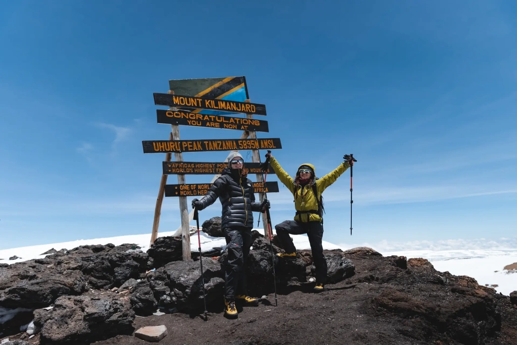
- Uhuru — 5,895 meters (19,341 ft)
The difference in altitude of 210 meters (689 feet) between Gilman's Point and Uhuru Peak is just the variation between different elevations on the crater rim. Both are higher than the altitude of the Everest base camp.
Why do some climbers fail to reach Uhuru Peak?
Expeditions last about a week, and on the day of the summit assault at high altitude, many feel tired and weakened, affected by altitude sickness. The climb to Uhuru Peak via Gilman's Point starts at about midnight and is the hardest hike of the expedition. National park rules allow considering the ascent complete at any of the three summit points on the crater rim, including Gilman's Point. Reaching this point earns a "bronze certificate." A "silver" is given for finishing at Stella Point. For the "gold," one must reach Uhuru.
Why is it called Gilman's Point?
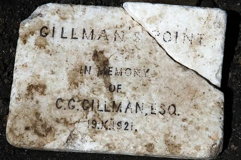
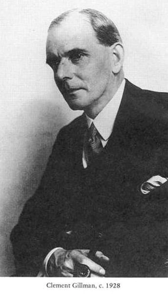
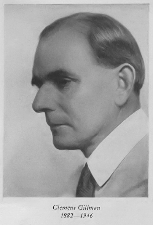
This point was reached in 1921 by engineer and explorer Clement Gillman, who lived and worked in what is now Tanzania. This occurred during a major expedition, in which he alone managed to reach the Kibo crater. At the time, there were a lot of glaciers and snow on the summit of Kilimanjaro, so not everyone could climb so high. It suffices to say that prior to this, only five expeditions had managed to reach the main summit.
British expeditions to Kilimanjaro
To understand the historical significance of this expedition, one must know the context. In the late 19th and first half of the 20th century, the territories of East Africa were managed by representatives of European countries, and there was a struggle for influence in the region. Until 1919, the mainland part of modern Tanzania belonged to the German Empire, and the first ascents were predominantly made by Germans. But after its defeat in World War I, Germany ceded future Tanzania to Great Britain.
The first British expedition to Kilimanjaro took place in 1921. That same one in which Gillman participated. He was not the first Briton to set off for Kilimanjaro, but the first to reach the Kibo crater. It was in the interests of the British administration of the colony to immortalize this event.
Determining the height of Kilimanjaro
Incidentally, that expedition was not Clement Gillman's first. Before that, he climbed Kilimanjaro in 1909, but did not reach the crater. There is also another significant event that made Gillman's success in 1921 known. He was the first in history to determine the altitude of Kilimanjaro using the boiling point of water. It is known that at sea level, water boils at 100°C, and . Knowing the boiling point allows one to calculate the altitude quite accurately.
These led to the naming of this place in honor of Clement Gillman. At first, he objected, but, as his biographer later recounted, he was proud of the decision. The fact is that near this place is a point known as Johannes Notch. This is a gap in the glacier on Kibo that existed at that time, discovered and used to reach the crater by German climber Kurt Johannes. Gillman found records and maps of the Germans in this place, which had been preserved for over 20 years. Therefore, he insisted on preserving the name of Captain Johannes as the priority. But fate decided otherwise, and today we know this place as Gilman's Point.
The error on the sign
Besides the "changed" height of Gilman's Point, there is another inaccuracy in the modern sign. Or rather, it has always been on the signs that were installed here earlier. You may have already noticed it.
All the signs say Gilman’s Point, while the engineer-explorer's surname is spelled with two l's—Gillman. Surprisingly, this error has been carried from sign to sign for decades.
We hope that one day historical justice will prevail, and Clement Gillman's name will be spelled correctly.
Who was Clement Gillman?
Gillman was a British engineer who lived in Tanganyika for over 40 years, as the mainland part of today's Tanzania was called a century ago. He held engineering positions first in the field of railway construction and then in water supply.
Gillman's work in Tanganyika
He arrived in Tanganyika in 1905 as a surveyor, and after World War I became the chief engineer of the Tanganyika Railways. During this period, construction of new lines and stations was actively underway. In the last couple of years before retirement, Gillman advised the government on water resource issues.
But this is only the official part of Clement Gillman's biography. His passion was travel and geographical research. Moreover, he sincerely tried to do as much as possible for the development of Tanganyika and to improve the lives of the local population. Disliking injustice, he often criticized other foreigners who enjoyed the benefits of Tanganyika at the expense of the locals. Politicians and schemers also received their share. In Gillman's opinion, everything should be based on the principles of fairness and a scientific approach.
Another notable chapter in the biography of the engineer and explorer—Clement Gillman, together with Richard Royce and two other mountain enthusiasts Rice and Ungerer, organized the Mountain Club of East Africa in 1929. It still exists in Tanzania today, now called the Kilimanjaro Mountain Club.
Upon retiring, Gillman continued to live in the African country he passionately loved and explored. On October 5, 1946, he was flying from Dar es Salaam to Moshi. On board the plane, in the sky above beloved Tanganyika, with a notebook and pencil in his hands, he passed away.
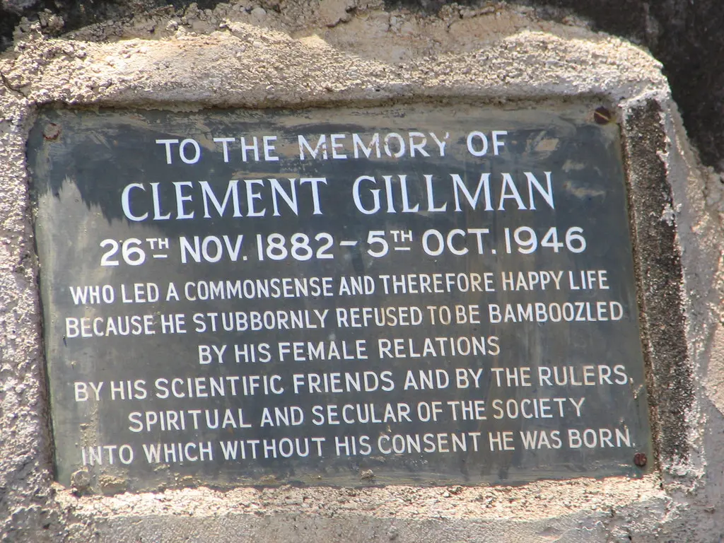
The inscription on the tombstone reads:
“To the memory OF Clement Gillman 26th NOV 1882 - 5th OCT.1946 Who led a commonsense and therefore happy life because he stubbornly refused to be bamboozled by his female relations by his scientific friends and by the rulers spiritual and secular of the society into which without his consent he was born.”
Remembering Clement Gillman
Here's how Clement Gillman was remembered in obituaries: Tanganyika lost “one of its oldest, best and most learned friends”, “there was a sense, indeed, in which he was Tanganyika, for he embodied in a way that nobody else could possibly have done the whole of the Territory’s history since the turn of the century”.
Remember this man when you find yourself at the sign on Gilman's Point. If you want to read more about the life and achievements of Clement Gillman, find the book by Brian Hoyle, “Gillman of Tanganyika, 1882–1946: The life and work of a pioneer geographer”.
All content on Altezza Travel is created with expert insights and thorough research, in line with our Editorial Policy.
Want to know more about Tanzania adventures?
Get in touch with our team! We've explored all the top destinations across Tanzania. Our Kilimanjaro-based adventure consultants are ready to share tips and help you plan your unforgettable journey.


