





 52 reasons
  Free PDF


 Message us on WhatsApp
  Book a Free Call

 Climbing
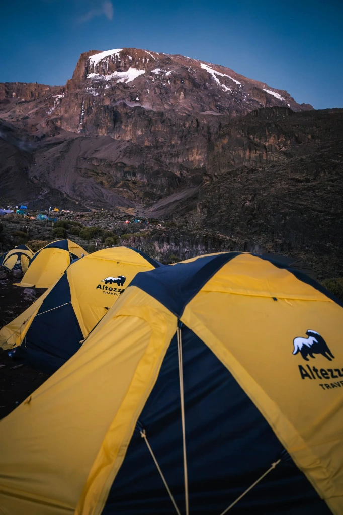
Mount Kilimanjaro is 5,895 meters (19,341 feet) above sea level. Its highest point, Uhuru Peak, lies on the crater rim of Kibo, the tallest of the mountain's three volcanic cones.
Kilimanjaro is Africa's highest mountain and the tallest free-standing mountain in the world. Unlike peaks that form part of a major range, it rises in relative isolation above the surrounding plains. Thousands of people come to climb Kilimanjaro every year. This blog post will answer the common questions about Kilimanjaro’s height, elevation gain, starting points for climbing, and more.
How tall is Mount Kilimanjaro?
The elevation of 5,895 meters (19,341 feet) refers to Kilimanjaro’s height above sea level. It is not the same as the total vertical distance a climber gains on the way to the summit.
From the surrounding plains, Kilimanjaro rises roughly 4,877 meters (16,000 feet). This exceptional vertical rise is one of the mountain's defining features and helps explain why Kilimanjaro appears so imposing, even though its summit is lower than those of the world’s highest peaks.
Its isolated position and dramatic rise above the surrounding landscape are also what give Kilimanjaro its distinction as the world’s highest free-standing mountain.
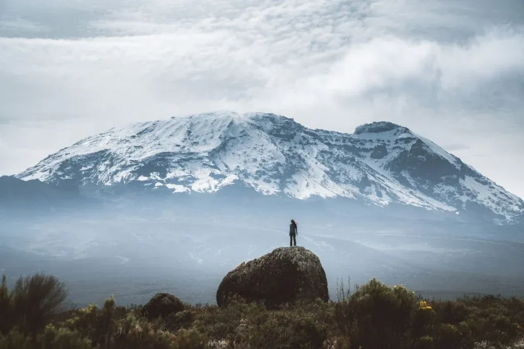
How high is Kilimanjaro in feet and meters?
These figures refer to the summit elevation above sea level.
What is the highest point on Mount Kilimanjaro?
Uhuru Peak
Uhuru Peak is the highest point on Mount Kilimanjaro. It sits on the southern rim of Kibo’s crater and marks the endpoint of the standard trekking routes.
From the summit area, the terrain drops into Kibo’s vast volcanic crater. Inside the crater are several geological features, including the Reusch Crater and the Ash Pit. The upper slopes of Kibo are also home to most of the mountain’s remaining ice and snow.
Uhuru Peak is both the highest point in Tanzania and the highest point on the African continent. For trekkers, reaching the summit usually means standing at the Uhuru Peak sign before descending from the summit area.
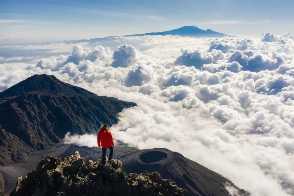
Kibo, Mawenzi and Shira
Kilimanjaro consists of three volcanic cones formed at different stages of the mountain’s history: Kibo, Mawenzi and Shira.
- Kibo – 5,895 m (19,341 ft) at its summit. It is the largest of the three cones and the only one with a relatively broad, accessible summit area.
- Mawenzi – 5,149 m (16,896 ft). Its heavily eroded ridges, pinnacles and steep cliffs give it a much more rugged appearance than Kibo.
- Shira – about 3,962 m (13,000 ft) at its highest remaining point. Much of the original cone has collapsed or eroded, leaving the broad Shira Plateau.
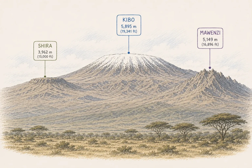
The three cones have very different landscapes. Kibo has broad upper slopes surrounding its crater, Mawenzi is dominated by sharp volcanic rock formations, while Shira has been reduced to a plateau by erosion and volcanic collapse.
Mawenzi is not included on ordinary Kilimanjaro trekking routes. Climbing its higher sections involves exposed, technical terrain and requires mountaineering skills and permission from the Kilimanjaro National Park management.
How was the height of Mount Kilimanjaro measured?
Kilimanjaro’s elevation has been measured several times, producing slightly different results. These differences do not indicate that the mountain itself has changed height. They largely reflect improvements in surveying methods, changes in reference systems and differences in how elevation is calculated.
Early estimates were higher than the figure used today. During the 1889 expedition, German geographer Hans Meyer estimated Kilimanjaro’s height at more than 6,000 meters (19,685 feet).
A British survey in 1952 produced an elevation of 5,895 meters (19,341 feet), which subsequently became the conventional figure for the mountain.
Later GPS-based surveys produced slightly lower values. A 1999 survey, for example, calculated an orthometric height of approximately 5,892.55 meters (19,333 feet). Other subsequent measurements have also placed the summit below 5,895 meters.
The difference comes partly from the way elevation is defined and measured. GPS determines position relative to a mathematical reference surface called an ellipsoid, whereas mountain elevation is normally an orthometric height related to mean sea level. Converting a GPS measurement into an orthometric height requires a geoid model, and different models can produce slightly different results.
For practical purposes, 5,895 meters (19,341 feet) remains the standard elevation used for Mount Kilimanjaro.
How high is Kilimanjaro compared with the Seven Summits?
At 5,895 meters (19,341 feet), Mount Kilimanjaro is the fourth-highest of the Seven Summits, the highest mountain on each continent. It is lower than Mount Everest, Aconcagua, and Denali, but higher than Mount Elbrus, Mount Vinson, and Puncak Jaya.
How much elevation do you gain when climbing Kilimanjaro?
Mount Kilimanjaro’s summit elevation of 5,895 meters (19,341 feet) does not represent the amount of elevation a climber gains during the trek. Since every route starts well above sea level, the actual elevation gain is considerably smaller.
Starting elevations on Kilimanjaro
The starting elevation varies significantly between routes:
- Machame Route: starts at 1,740 m (5,709 ft)
- Rongai Route: starts at 1,950 m (6,398 ft)
- Lemosho Route: starts at 2,100m (6,890 ft) for 8-day itineraries, or at 3,414 m (11,201 ft ) for 6-7 day itineraries
- Marangu Route: starts at 1,860 m (6,102 ft)
- Umbwe Route: starts at 1,800 m (5,904 ft)
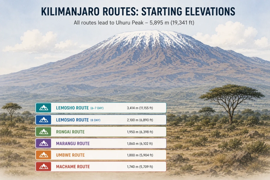
The difference matters when comparing routes, but a higher starting point does not automatically mean an easier climb. Acclimatization depends more on how quickly you gain altitude and how much time you spend at higher elevations.
How much elevation do you gain?
The theoretical elevation gain from a route’s starting point to Uhuru Peak ranges from roughly 2,500 to 4,150 meters (8,100 to 13,600 feet), depending on the route and itinerary. The actual elevation climbed on foot can be slightly higher.
Expert note: One advantage of Kilimanjaro is that you spend most of the climb either gaining elevation or traversing relatively level terrain, with relatively little elevation loss. This also makes the descent from Uhuru Peak comparatively straightforward: once you leave the summit, it is mostly downhill. If you become unwell, you do not necessarily have to retrace the entire route. From any camp, you can descend toward a park exit, typically reaching it within 5–8 hours, depending on your location and condition.
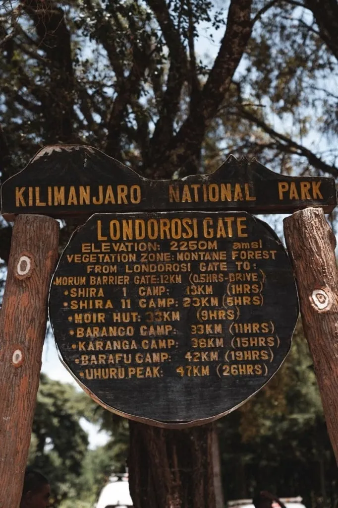
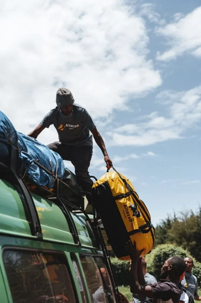
How does Kilimanjaro’s elevation affect climbers?
Kilimanjaro’s elevation makes altitude the climb's main physical challenge. At higher elevations, atmospheric pressure is lower, and the body receives less oxygen with each breath. The higher a climber goes, the more important acclimatization becomes.
Unlike a technical mountain, Kilimanjaro does not require ropes, climbing equipment, or advanced mountaineering skills. The difficulty comes largely from spending several days ascending to extreme altitude and then making the final climb to Uhuru Peak.
This is why the number of days on the mountain matters. Longer itineraries of 7+ days allow the ascent to be spread over more time, giving the body more opportunity to adjust before the summit attempt. In other words, when considering Kilimanjaro’s height, how quickly you reach that elevation is often more important than the elevation itself.


FAQs about Kilimanjaro’s height
Mount Kilimanjaro is 5,895 meters (19,341 feet) above sea level at Uhuru Peak, its highest point. It also rises roughly 4,877 meters (16,000 feet) above the surrounding plains, giving it an exceptionally large vertical rise for an isolated mountain.
Kilimanjaro’s summit elevation is 19,341 feet above sea level. Uhuru Peak, on the crater rim of Kibo, is the highest point on the mountain.
Mount Kilimanjaro is 5,895 meters above sea level at Uhuru Peak. This is the commonly used elevation, although modern measurements can differ slightly.
Uhuru Peak is the highest point on Mount Kilimanjaro, at 5,895 meters (19,341 feet) above sea level. It is located on the crater rim of Kibo, the largest and highest of Kilimanjaro’s three volcanic cones, and is also the highest point in Africa.
Yes. Kilimanjaro’s Uhuru Peak reaches 5,895 meters (19,341 feet), while Mount Kenya’s highest summit, Batian, reaches 5,199 meters (17,057 feet).
Elevation gain depends on the route and starting point. For example, Machame Gate is at about 1,740 meters (5,709 feet), giving a net elevation gain of approximately 4,155 meters (13,632 feet) to Uhuru Peak. On 6–7-day Lemosho itineraries, which start at about 3,414 meters (11,201 feet), the net gain is approximately 2,481 meters (8,140 feet). Kilimanjaro routes generally involve relatively little elevation loss, with most of the climb spent either gaining altitude or traversing relatively level terrain.
No. Mount Everest is the world’s highest mountain above sea level, at 8,848 meters (29,031 feet). Kilimanjaro is the highest mountain in Africa and the world’s highest free-standing mountain.
Kilimanjaro’s summit is 5,895 meters (19,341 feet) above sea level, compared with 8,848 meters (29,031 feet) for Mount Everest. Everest is therefore 2,953 meters (9,690 feet) higher. Despite the difference, Kilimanjaro has a remarkable vertical rise because it stands in relative isolation rather than forming part of a major mountain range.
All content on Altezza Travel is created with expert insights and thorough research, in line with our Editorial Policy.

Want to know more about Tanzania adventures?
Get in touch with our team! We've explored all the top destinations across Tanzania. Our Kilimanjaro-based adventure consultants are ready to share tips and help you plan your unforgettable journey.
 Climbing
  Safari
  About Altezza
  Islands