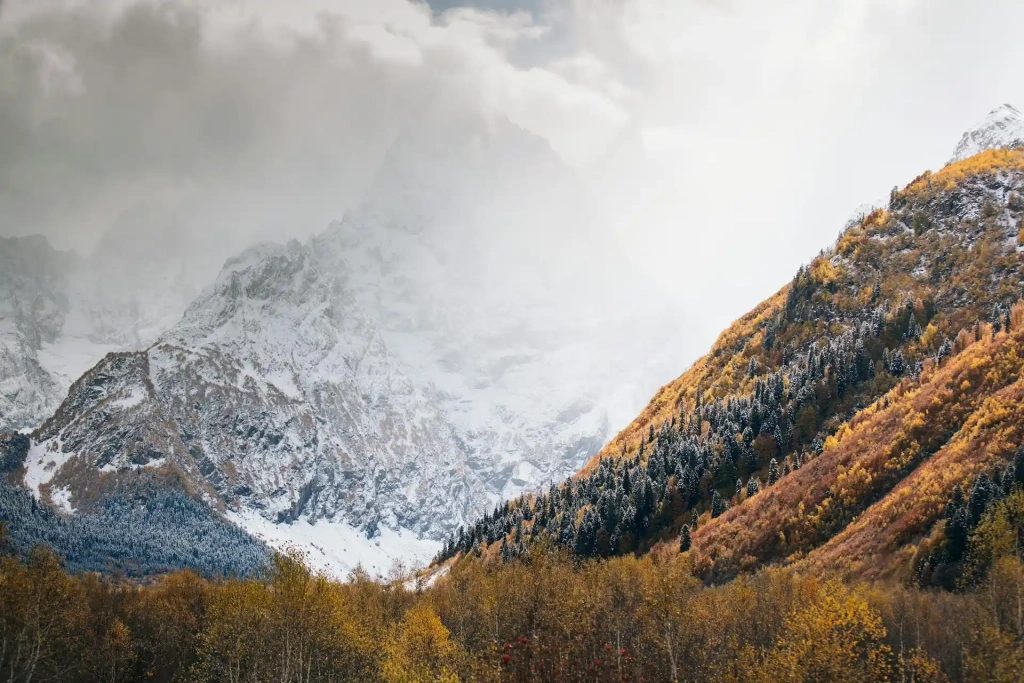
Europe is home to some of the world's most majestic mountains, offering breathtaking views and challenging climbs. From the snow-covered Alps to the towering peaks of the Caucasus, we will introduce you to the 10 highest mountains in Europe.
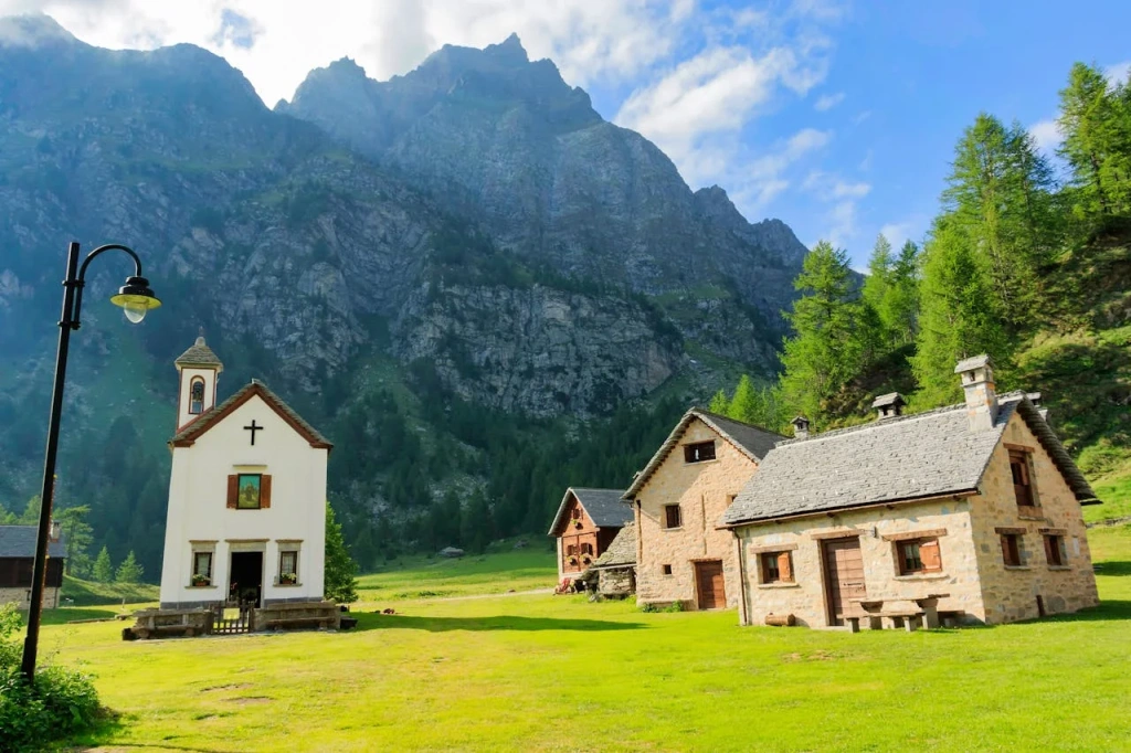
Follow in the footsteps of Leonardo da Vinci, begin your ascent from a medieval village in Svaneti, spend the night in a futuristic alpine hut in the Alps, and visit the "City of the Dead" dating back to the first millennium. All this is just a small part of Altezza Travel's virtual route to Europe's highest peaks. Let's begin!
10. Monte Rosa
- Location: Swiss Alps, Switzerland
- Elevation: 4,634 meters (15,203 feet)
- Difficulty: Class 3
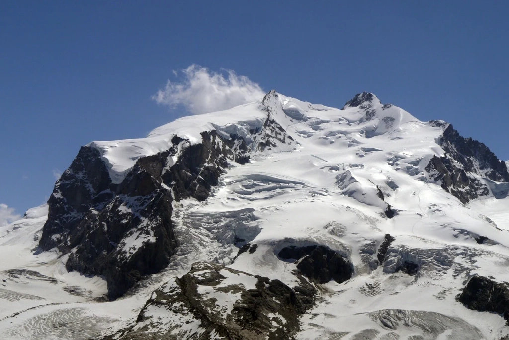
One of the most intriguing mountains on our list, both in terms of ascents and history. But let's start with a small clarification: Monte Rosa is a mountain massif in the eastern part of the Pennine Alps, on the border of Italy and Switzerland. Depending on the counting method, it includes from 10 to 19 peaks, each with numerous routes. They vary in difficulty, but the most popular ones are often classified as Class 3.
To reach one of the peaks, you need experience hiking at altitudes of at least 4,000 meters (13,123 feet), excellent physical fitness, and proficiency with mountaineering equipment, along with basic rock and ice climbing skills. Climbers can expect long daily hikes lasting 8–9 hours and the challenge of steep snowy slopes and glaciers.
The highest peak of the massif is Dufourspitze, standing at 4,634 meters (15,203 feet). The first ascent took place on August 1, 1855, by a group of climbers led by Englishman Charles Hudson. Incidentally, that same year, he became the first person to climb Mont Blanc without a guide, and in 1865, he was part of the team that first ascended the equally famous Matterhorn, becoming one of four climbers who died during the descent.
Today, the slopes of this massif are very popular among climbers. But even a brief description of all existing routes would make this article as thick as a book. So we'll focus on two options: the ascent to Dufourspitze and the Spaghetti Tour.
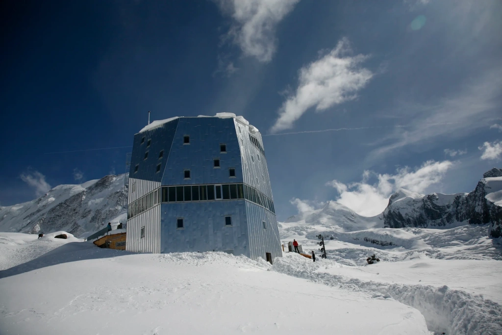
The main route to Dufourspitze starts in Zermatt, where climbers take the scenic Gornergrat railway to Rotenboden station at an altitude of 2,815 meters (9,236 feet). From there, the trail leads through the Gorner and Grenz glaciers directly to the Monte Rosa Hut (2,883 meters or 9,459 feet). This futuristic building, shaped like a crystal, offers comfortable accommodation, delicious food, and stunning views of the Alps. It also serves as a base camp: from the hut to the summit and back takes about 10–12 hours. The most challenging section is on the western ridge near the peak. It is a rocky area covered with ice and snow that requires technical mountaineering skills. It's important to note that the descent often occurs around noon, meaning the ice you climbed may start to melt. The route takes about two to three days.
The Spaghetti Tour, on the other hand, takes advantage of Monte Rosa being a massif. It doesn't include an ascent to Dufourspitze but offers the opportunity to conquer several lower peaks over 4–8 days. The classic route starts in Cervinia, a ski resort on the Italian side of the Matterhorn, passes through several four-thousanders, including Pyramid Vincent, Balmenhorn, Ludwigshöhe, and Zumsteinspitze, and ends at the resort of Gressoney in the Aosta Valley. The tour is notable not only for its rich climbing program but also for its comfort. Travelers spend nights in cozy mountain huts with excellent Italian cuisine.
Where are the 10 highest mountains in Europe?
These mountains are primarily located in the Caucasus Mountains along the border between Russia and Georgia. The exceptions are Mont Blanc and Monte Rosa, which are situated in the Alps in France and Switzerland, respectively.
9. Mount Ushba
- Location: Caucasus Mountains, Georgia
- Elevation: 4,710 meters (15,453 feet)
- Difficulty: Class 4 and 6
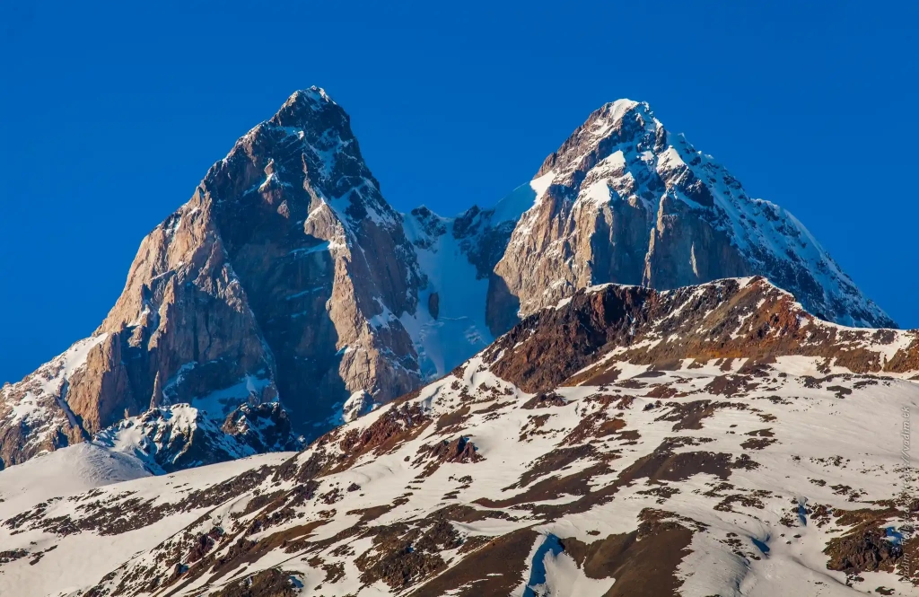
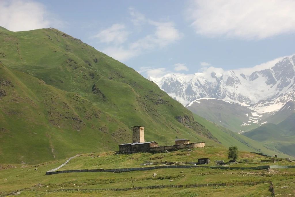
The dangerous and formidable Ushba is the perfect challenge for elite climbers willing to accept extreme risk to conquer its summit. Located in Georgia's historic region of Svaneti, its name translates from the local language as "Mountain of Grief."
Its distinguishing feature is a double summit with nearly vertical granite walls. The North Summit, at 4,690 meters (15,387 feet), was first ascended in 1888. The most optimal route runs along the northeast ridge, classified as difficulty Class 4. The journey includes crossing the Ushba Pass and navigating icefalls with numerous crevasses and steep rocky sections.
For the highest South Summit, at an elevation of 4,710 meters (15,453 feet), it's best to ascend via the south face. This route is much more difficult but is considered the easiest among those leading to this summit. Climbers should be prepared for difficulty Class 5. The main challenge is the infamous "Mirror of Ushba": a smooth, sheer cliff over a kilometer long. It was first overcome only in 1964, and since then, few attempts to repeat it have been successful. The ascent on both routes takes about 7–9 days.
Another feature of this mountain is its unpredictable microclimate. Even when sunny weather prevails in the valley below, both peaks of Ushba can be shrouded in fog or clouds, and it's almost always windy between the summits.
8. Mount Dzhimara
- Location: Caucasus Mountains, Russia
- Height: 4,780 meters (15,682 feet)
- Difficulty: Class 3 and 4
Dzhimara is the second-tallest peak in the North Ossetia region after Mount Kazbek. Although it's only nine kilometers from Kazbek, it isn't as popular among climbers.
The mountain's summit is covered with firn fields—compacted perennial snow. Four glaciers descend from its slopes: Midagrabin, Kolka, Western, and Central Suatisi. The first person to reach its summit was German climber and geographer Gottfried Merzbacher in 1891. His route remains relevant today and is classified as a third-category difficulty.
A similar route in terms of difficulty is the trail via the Northern Ridge. Two other routes are classified as fourth-category, involving traversing switchbacks and glaciers with open crevasses, as well as climbing steep rocky and icy walls.
7. Mont Blanc
- Location: European Alps, France/Italy
- Elevation: 4,808 meters (15,774 feet)
- Difficulty: Class 3 and 4
In both professional and amateur circles, Mont Blanc needs no introduction. It's the tallest mountain in the Alps, one of the major European mountain ranges. Despite being a relatively accessible peak, it is also one of the most dangerous in the world, claiming up to a hundred lives each year.
Many routes leading to the summit are considered not particularly difficult and accessible to amateur climbers. This is partly true, but such descriptions attract a vast number of enchanted novices, which is one reason for the high mortality rate. Even on the easiest routes, climbers need impeccable physical fitness, experience conquering other four-thousanders, and basic rock and ice climbing skills.
The first ascent to the mountain's summit was made by Jacques Balmat and Michel Paccard in 1786, marking the birth of modern mountaineering. Today, numerous trails lead to the peak. The classic and least technical route is the Gouter Route, which passes through the Tête Rousse Hut (one of the highest mountain huts in the Alps) and the notorious Gouter Refuge, infamous for rockfalls. The ascent via this route takes about three days.
Another well-known trail is the "Three Monts" route. It is more technical and physically demanding. It starts from the upper station of the Aiguille du Midi cable car at an altitude of 3,842 meters (12,605 feet) above sea level and leads to Mont Blanc's summit via Mont Blanc du Tacul and Mont Maudit. The route became the second most popular due to easy access from the cable car.
It would be remiss not to mention the Grand Mulets, the historical route of Balmat and Paccard, even though climbers today often avoid it. This picturesque but very long route mainly passes through a dangerous section prone to serac falls. To avoid spending too much time there, climbers opt for alternative paths, using this one mainly for ski descents.
Is Mont Blanc the highest mountain in Europe?
No, Mont Blanc is not the highest mountain in Europe. Mont Blanc, located in the Alps on the border between France and Italy, stands at 4,808 meters (15,774 feet) and is the tallest peak in Western Europe. The highest mountain in Europe is actually Mount Elbrus in Russia's Caucasus Mountains, which rises to 5,642 meters (18,510 feet). Mont Blanc was once considered Europe's highest peak before Mount Elbrus was recognized within Europe's geographical boundaries.
6. Mount Tetnuldi
- Location: Caucasus Mountain Range, Georgia
- Elevation: 4,858 meters (15,938 feet)
- Difficulty: Classes 2 and 4
There aren't many mountains on the planet with a pyramidal shape, and Tetnuldi is one of them.
It was first conquered in 1887 by a group of English climbers led by Douglas Freshfield, who reached the summit via the southwest ridge. Their route remains accessible today and is classified as second-category difficulty. Technically, it's not complicated but requires experience in using crampons and skills with an ice axe and rope. Therefore, Tetnuldi shouldn't be the first mountain you decide to conquer.
Some sources mention the existence of several other routes, including fourth-category ones, notably on the mountain's western face. However, reliable descriptions of these trails and offers from operators to ascend them are scarce.
5. Mount Kazbek
- Location: Caucasus Range, Georgia / Russia
- Elevation: 5,054 meters (16,581 feet)
- Difficulty: Class 2
Kazbek is the second most popular five-thousander in Russia and often becomes the next goal after conquering Mount Elbrus. Geomorphologically, it's a stratovolcano with two summits, standing on the border with Georgia. You can start the ascent from either side, provided you obtain a permit to enter the border zone.
The most popular route is the southern (Georgian) one. It starts at an altitude of 1,750 meters (5,741 feet) in the village of Stepantsminda, from where you can make acclimatization hikes to the Gergeti Trinity Church (2,170 meters or 7,119 feet) and the Arsha Pass (2,930 meters or 9,613 feet). This is followed by a climb to the camp at the old Meteostation (3,700 meters or 12,139 feet). The next morning, climbers make an acclimatization hike to the Kazbek Pass (4,300 meters or 14,108 feet), where they undergo ice climbing training. The following day, the group sets out for the summit. The entire journey takes from four to eight days.
The northern (Russian) route is somewhat longer and more challenging climb due to less infrastructure and the need to overcome dangerous sections. However, many find it more interesting. The path to the summit passes by hot thermal springs, the Mayly Glacier, and Dargavs—the "City of the Dead," an Alanian necropolis dating back to the end of the first millennium. The most challenging part of the route is the ascent along the northwest buttress of Peak Ozhd. The entire journey takes about ten days round-trip. Both routes are classified as second-category technical difficulty.
Aside from these, there are several other trails to the summit, including third-category ones. Previously, they were used by more advanced climbers, but over time they've become deserted. The melting ice has exposed the mountain's rocky terrain, leading to frequent rockfalls, making these paths dangerous
4. Koshtan-Tau
- Location: Caucasus Range, Russia
- Elevation: 5,151 meters (16,899 feet)
- Difficulty: Classes 4 and 6
One of the most inaccessible mountains of the Caucasus Range, Koshtan-Tau is almost certainly on the wish list of those who have already been to Elbrus, Kazbek, and Tetnuldi. Climbing Koshtan-Tau is considered a serious mountaineering challenge since even the easiest route has a fourth-category difficulty.
The ascent follows the northern ridge and passes through the Mizhirgi Glacier, climbing up the third stage of the icefall. The route then continues through hazardous areas prone to rockfalls and over the summit of Mount Dumala-tau, which stands at 4,681 meters (15,358 feet). And all this is just a small part of a journey lasting at least two weeks. The ascent to the highest peak will require even more dedication.
Participation in the expedition requires experience in conquering other five-thousanders via routes no lower than third or fourth category. Climbers must be skilled in moving along steep trails, scree slopes, and glaciers in a rope team, as well as basic mountaineering techniques like ascending and descending fixed ropes.
3. Mount Shkhara
- Location: Caucasus Range, Georgia / Russia
- Elevation: 5,193 meters (17,037 feet)
- Difficulty: Class 5
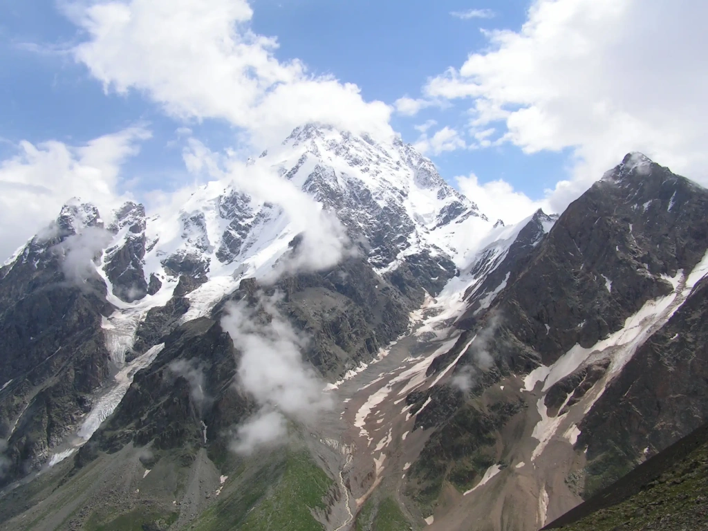
Opening our top three is Shkhara, located on the border of Georgia and Russia. Like Switzerland's Monte Rosa, it's a mountain massif with multiple peaks, the highest of which rises 5,193 meters (17,037 feet) above sea level.
The massif is part of the Bezengi Wall, a section of the Caucasus mountain range featuring its highest peaks. Due to the complex terrain with rocky and icy sections, the wall is called the "Little Himalayas." The first ascent of Shkhara was made in 1888 by John Garford Cockin and Ulrich Almer. Soviet climbers reached the summit only in 1933.
There are two relatively popular routes to Shkhara's summit, both classified as the highest difficulty level, accessible to only a few climbers, even among professionals. The expedition's program typically includes ascending the Chalaat Glacier, climbing rocks to the Southern Buttress of Shkhara South, and navigating complex rocks and ridges to the base of a chimney with a subsequent ascent along the summit's rocky belt. This describes just a few days of the two-week climb. Instead of listing extensive experience and skill requirements, let's just say that a climber aiming to challenge this mountain should be capable of just about everything.
2. Dykh-Tau
- Location: Caucasus Mountains, Russia
- Elevation: 5,204 meters (17,073 feet)
- Difficulty: Classes 4 and 5
The second-highest mountain in Europe, Dykh-Tau, is located within the Kabardino-Balkarian High Mountain Reserve, not far from the Bezengi Wall. It is a complex pyramidal massif with two summits: Main (5,204 meters or 17,073 feet) and Eastern (5,180 meters or 16,995 feet).
The first ascent was made in 1888 by the legendary British climber Albert Frederick Mummery. He is not only known for conquering Dykh-Tau but also for the first-ever attempt to climb an eight-thousander—the notorious Nanga Parbat. Mummery did not return from that expedition.
Today, more than ten routes of fourth and fifth-category difficulty lead to Dykh-Tau. One of the safer options is the combined route along the Northern Ridge, laid in 1888 by Englishman John Cockin. The path to the summit includes scree and ice sections through the Bezengi Gorge, the western ridge of Misses-Tau Peak, and numerous steep slopes of rock and ice.
Climbers are required to have experience ascending mountains higher than 5,000 meters (16,404 feet) via routes of second and third-category difficulty. The main dangers when climbing Dykh-Tau are rockfalls, avalanches, and sudden weather changes, including thunderstorms.
1. Mount Elbrus
- Location: Caucasus Mountains, Russia
- Elevation: 5,642 meters (18,510 feet)
- Difficulty: Class 1–5
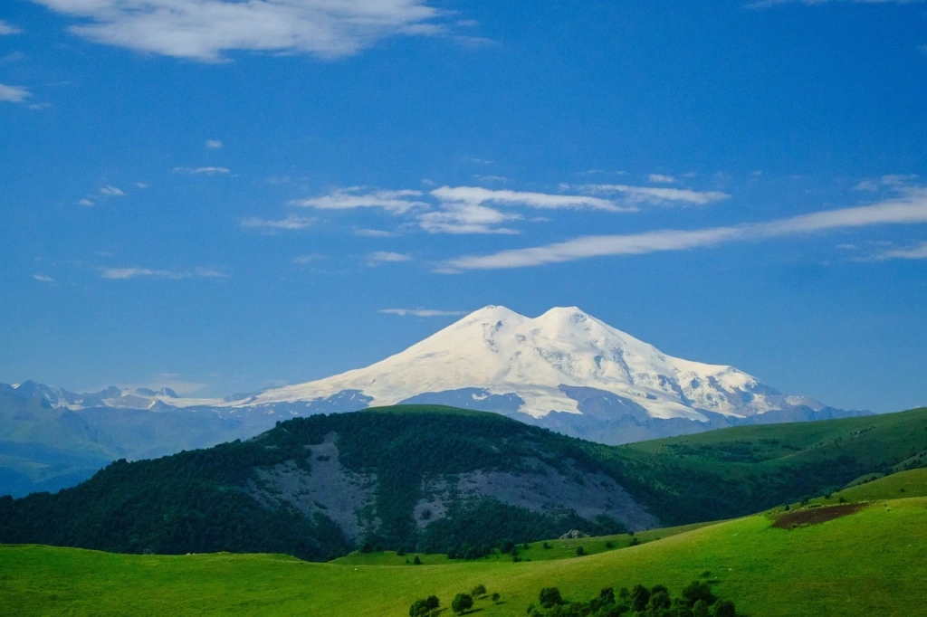
The highest mountain in Europe, the tallest stratovolcano on the Eurasian continent, and a member of the Seven Summits—the majestic Mount Elbrus. It towers with two peaks: the Eastern summit (5,621 meters or 18,442 feet) and the Western summit (5,642 meters or 18,510 feet).
The first ascent of the Eastern Peak was made by Killar Khashirov in 1829. He was a guide in a scientific expedition but was the only one to reach the summit. The Western Peak was first climbed in 1874 by members of a British expedition led by climber and writer F. Crauford Grove.
At first glance, the two peaks seem close to each other. In reality, they are more than one and a half kilometers apart. For those wondering if it's possible to conquer both summits of this prominent mountain in one ascent, the answer is yes. But let's discuss everything in order.
Today, about ten routes are laid on Mount Elbrus. The simplest and, accordingly, most popular among amateurs is the Southern Route, classified as first-category difficulty. It involves ascending a gentle slope with stops in comfortable huts up to the Pastukhov Rocks (4,700 meters or 15,420 feet). From there, climbers ascend to the saddle between the peaks, providing access to either one. The entire expedition takes about a week.
For those who have previously climbed to significant heights, there are several second-category routes. These include ascending both peaks in one go. In this case, you'll have to overcome more complex and steep sections, including the Lenz Rocks, Irkchat Gorge, or the glacier before the mountain's eastern ridge.
Experienced climbers ready for third-category routes choose combined paths to the Western peak, passing along the northwest slope. Those confident in their abilities may attempt to ascend the Western Shoulder (Dome) via the southern wall, a route classified as fifth-category difficulty.
What is Europe's most prominent mountain?
By the way, Mount Elbrus isn't the only mountain from the "Seven Summits" list accessible to beginners. Another good example is Mount Kilimanjaro in Tanzania, the tallest free-standing mountain in the world. Its highest point is 250 meters (820 feet) higher, but the climb is accessible to most people. Eight routes lead to its summit, most of which offer a gentle acclimatization program and are suitable for a first ascent.
All content on Altezza Travel is created with expert insights and thorough research, in line with our Editorial Policy.
Want to know more about Tanzania adventures?
Get in touch with our team! We've explored all the top destinations across Tanzania. Our Kilimanjaro-based adventure consultants are ready to share tips and help you plan your unforgettable journey.


